Abrams Falls
The Abrams Falls trailhead is in Cades Cove, just past stop #10 on the Cades Cove Loop Road. You will see a sign. The trail connects with Hatcher Mountain, Hannah Mountain, and Little Bottoms trails at a ford over Abrams Creek.
This wide trail climbs two ridges and follows Abrams Creek to Abrams Falls, a 20-foot fall into a large pool. The trail is popular among families with children or seniors. Please do not swim in the pool. The undercurrent can be dangerous at Abrams Falls, and rapidly rising waters has caused many drownings.
More waterfalls
Length 2.5 miles one way.
Level of difficulty: Easy.
Elevations: Start 1,700 feet; end 1,500 feet.
Maps: USGS quads 148SE, Cades Cove; 148SW, Calderwood.
Abrams Falls Official Site
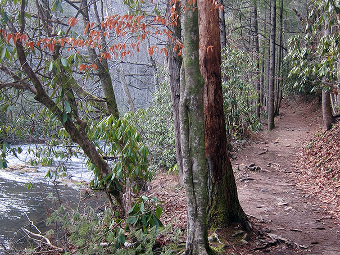
Abrams Falls Trail run alongside a beautiful mountain river.
Image by Jeaneane Payne
The Hike
This creek is named for Cherokee Chief Abram, who once lived on land now submerged under Lake Chilhowee, located on the western corner of the park. The trail starts by crossing a large footbridge over Abrams Creek. The stream here is a popular foot-cooler. To the right after the footbridge is a side trail to the Elijah Oliver house. Elijah Oliver was the son of the first white settler in Cades Cove in 1818, John Oliver. Another family dwelling, known as the John Oliver House, is the first house you see as you start the loop road.
The trail begins to climb gradually to reach a height above the stream, then turns a corner to the right and descends again to follow the river. The trail stays level for a considerable distance. In this stretch children frequently depart the trail to enjoy the water while their parents wait patiently. The trail then climbs toward a rocky point of Cades Sandstone at the top of Arbutus Ridge, and switches back to the right and descends again to Abrams Creek. It switches back again to the left over a side creek on a log bridge and curves right to follow the creek again for a flat stretch.
The trail then makes a final climb above Abrams Creek. It curves right at a point where you can hear the falls below you, then descends steeply to another log bridge over Wilson Branch. After crossing this bridge, the trail curves left to follow the creek on the other side. In a very short distance, another bridge appears to the left. Cross this bridge to follow the short spur trail to the 20-foot Abrams Falls. The pool at its base is 100 feet across and is a popular playground for children.
Be careful in the water at Abrams Falls because the rocks are extremely slippery, and it is easy enough to catch the edge of a rock in a fall. Parents should probably escort small children across the faster part of the stream (and the slicker rocks) to the shallow sand bar at the center of the pool.
From the turn onto the spur trail to the falls, the Abrams Falls Trail continues straight ahead. It winds along the bank of Abrams Creek for another 1.7 miles until it connects with the Hatcher Mountain, Hannah Mountain, and Little Bottoms trails at a ford over Abrams Creek that is dangerous in high water. From its junction with the Abrams Falls Trail, the Little Bottoms Trail leads in another 2.3 miles to the Abrams Creek Campground, off the Foothills Parkway and U.S. Highway 129 at the extreme west end of GSMNP.
Finding the Trailhead
Take U.S. Highway 321 from Maryville through Townsend. After the Townsend Visitors Center, turn right onto Laurel Creek Road to join the Cades Cove Loop and continue almost half of the way around the loop. Turn right between signposts 10 and 11 at the sign for Abrams Falls, just before reaching the Cades Cove Visitors Center. Take the dirt road to the large parking lot for the trailhead.
From Gatlinburg turn right at Sugarlands Visitor Center and go to Cades Cove.
|
|